


Convex Earth DEBUNKED - Dakila Research & CTZ - Zigurats Technology Center; Urandir Fernandes de Oliveira
Dear Urandir Fernandes de Oliveira,
The Earth is not convex. It's a beautiful blue globe.
You are in denial of scientific evidence. It's very interesting that of all living creatures on the Earth, human beings are the only ones to deny their living reality.
You suffer from self-denial, which is the refusal to accept reality or fact, acting as if a painful event, thought or feeling did not exist. It is considered one of the most primitive of the defense mechanisms because it is characteristic of early childhood development.
Denial, and also abnegation is used for a psychological defense mechanism, when a person is faced with a fact that is too uncomfortable to accept and rejects it instead, insisting that it is not true despite what may be overwhelming evidence.
This Denial is akin to Stephen Colbert’s “Truthiness,” in that these deniers adamantly refuse to accept verified scientific facts because they get in the way of their own rigid ideas....
It’s important to point out that no POSITIVE PROOF has ever been presented as evidence that the Earth is flat or convex. Only negative irrational and unscientific theories have been exhibited.

- - - - - - - - - - - - - - - - - - - - - - - - - - - - - - - - - - - - - - - - - - - - - - - - - - - - - - - - - - - - - - - - - - - - - - - - - - - - - - - - - - - - - - - - - - - - - - - -
Fact check:
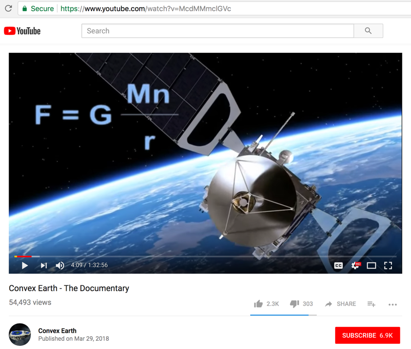
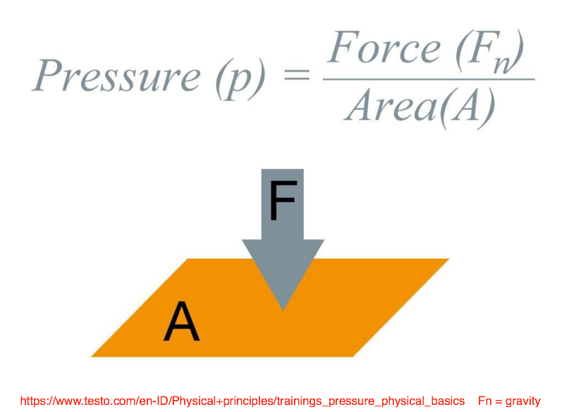
It's very interesting that the scientists, researchers and astronomers at your (Dakila Research and Zigurats Technology Center) got the formula for gravity wrong. Should be F = GMn/r2 What is presented in the screen shot directly below is incorrect. What does that say about the quality and accuracy of your claims?
- - - - - - - - - - - - - - - - - - - - - - - - - - - - - - - - - - - - - - - - - - - - - - - - - - - - - - - - - - - - - - - - - - - - - - - - - - - - - - - - - - - - - - - - - - - - - - - -
Fact check:
The following statement by Urandir Fernandes de Oliveira is very puzzling. He says, "we use the methodology of lilarial science because the results are much more precise."
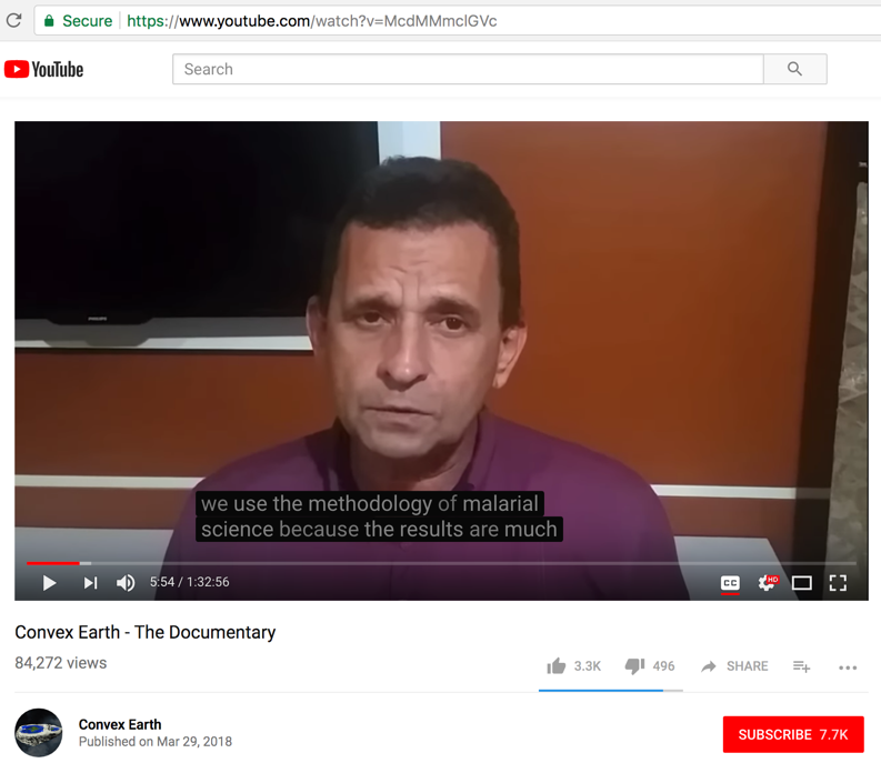
The Scientific Method, with continuous refinement, is what should be used instead. The Scientific Method successfully eliminates confirmation bias and assures that research is done in a systematic, objective, and verifiable way.

- -

- - - - - - - - - - - - - - - - - - - - - - - - - - - - - - - - - - - - - - - - - - - - - - - - - - - - - - - - - - - - - - - - - - - - - - - - - - - - - - - - - - - - - - - - - - - - - - - -
Fact check:
Are these researchers real scientists with University level bachelors (BA/BS), masters (MS), or doctorate (Ph.D.) degrees?
- -
- -
- -
- -
Eduardo Della Santa – CTZ researcher

Fact check:
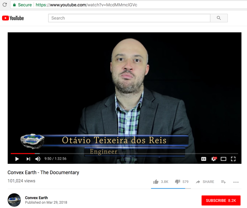
In this video Octavio Teixeira dos Ries claims to be an "Engineer," but his Facebook page below says that he is a life coach and studied finance.
- -

- - - - - - - - - - - - - - - - - - - - - - - - - - - - - - - - - - - - - - - - - - - - - - - - - - - - - - - - - - - - - - - - - - - - - - - - - - - - - - - - - - - - - - - - - - - - - - - -
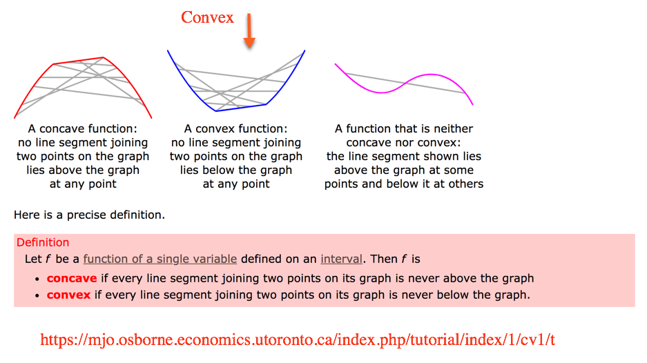
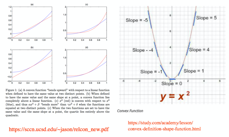
What are the properties of a convex geometrical shape?
A geometric shape is convex if all its edges point outward. No part of it curves or faces inward.
The convex shape can also be part of the surface of a sphere.
A convex shape has both a negative and positive slope (a measurement of steepness).
Here is more definition:
- -
- - - - - - - - - - - - - - - - - - - - - - - - - - - - - - - - - - - - - - - - - - - - - - - - - - - - - - - - - - - - - - - - - - - - - - - - - - - - - - - - - - - - - - - - - - - - - - - -
Fact check:
The 7 experiments that they list will now be examined for reasonableness and established scientific accuracy:
a) a geodesic experiment, which consists of measuring two buildings at a considerable distance
b) using sea level as a reference
c) a laser experiment to ascertain the flatness of water surfaces
d) leveling of water surfaces
e) optical distortions relating to processes of reflection
f) an experiment with boats on the horizon line
g) experiments involving gravity and heavenly bodies
- - -
THE EXPERIMENTS as documented in the video:
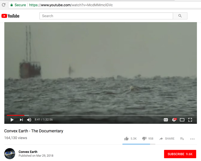
1. Boats & Horizon Line (6:00)
2. Long Range Telescope (12:05)
3. Radio Waves (14:24)
4. Laser Beam (16:08)
Sao Paulo on the beach of Caraguatatuba (Brazil) – to the beach of Ilhabela (Brazil)
Hooli Peru to beach Copacabana Bolivia
Três Marias Dam
Lake Titicaca
5. Geodesic Curvature in Buildings (22:47)
6. Geodesic Curvature in Water (28:23)
7. Laser Beam (revisited?) is visited twice from different locations it seems. (31:37)
- - -
THE RESULTS
1. Boats & Horizon Line (34:20)
2. Long Range Telescope (40:17)
3. Radio waves (42:08)
4. Laser beam (48:29)
5. Geodesic Curvature in Buildings (44:10)
6. Geodesic Curvature in Water (46:15)
7. Laser beam at different lake (54:40)
- - -
Addtional subject commentary areas:
1. Commentary: And the Satellites? (1:10:58)
2. Commentary: Gravity (58:17)
3. Commentary: If it is not spherical, what is the shape of the Earth? (1:05:34)
4. Commentary: And the photos taken from space? (1:11:47)
5. Commentary: The New Continent (1:18:08)
6. Commentary: The Solar System (1:20:06)
Update May 26, 2018: The documentary claims to have tested and proven results, which are still yet to be disclosed.
- - - - - - - - - - - - - - - - - - - - - - - - - - - - - - - - - - - - - - - - - - - - - - - - - - - - - - - - - - - - - - - - - - - - - - - - - - - - - - - - - - - - - - - - - - - - - - - -
Fact check:
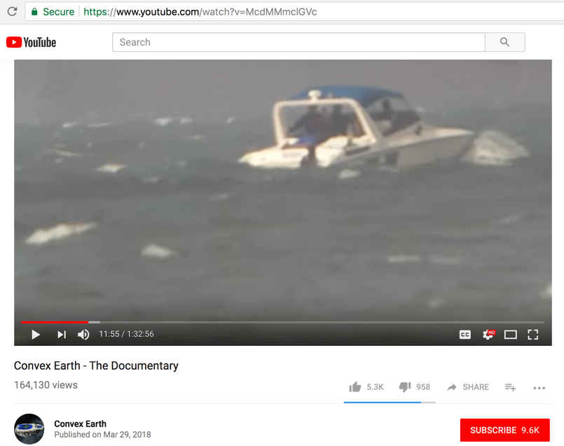
Starting at video time mark 7:05 & 34:25
Experiment 1. Boats & Horizon Line
The video describes what they did at location (Lagoa dos patos, in Rio Grande de Sul, Brazil). Although the video shows a surveyor Theodolite, no corresponding data (GPS position of ground telescope & 2 boats at different points in the test) was provided. Without such documentation, the scenery is nice but no observational data means no measured reliable results (convex or not).
Their stated objective was to show water flatness over a distance of 40-km by observing two boats as they move off into the distance. To map (never shown) and create a visual image of it.

-
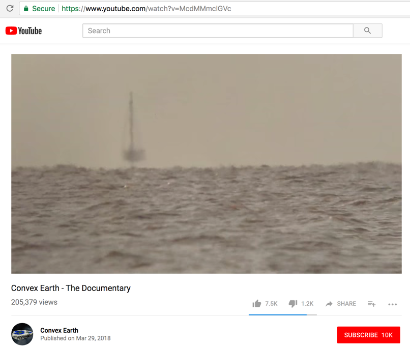
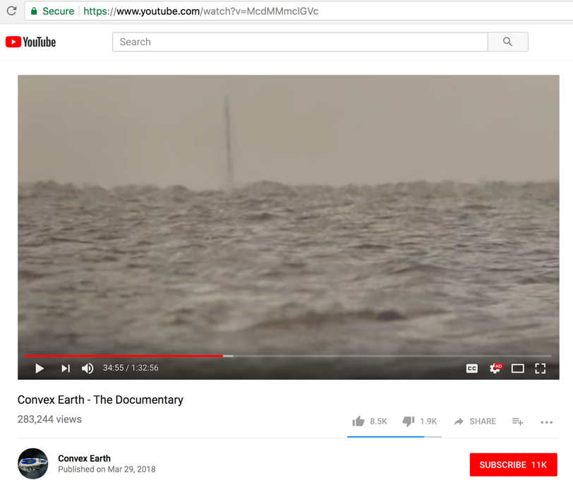
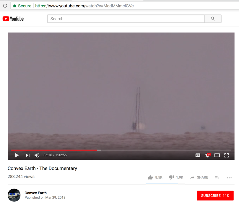
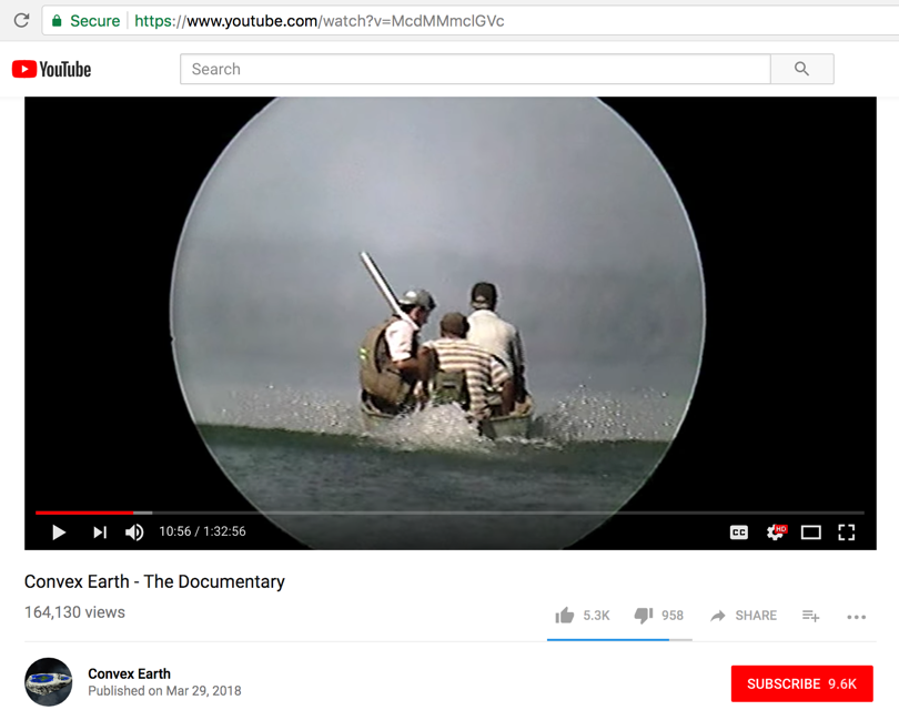
The photo above and the photo below show clear evidence of Earth spherical curvature.
The rightmost boat (in the photo below) only shows its mast while the main deck and living quarters remain unseen, already having traversed beyond and below the observable horizon line.
Now the hull of the larger boat disappears from view due to the Earth's spherical curvature...
Now just the mast...
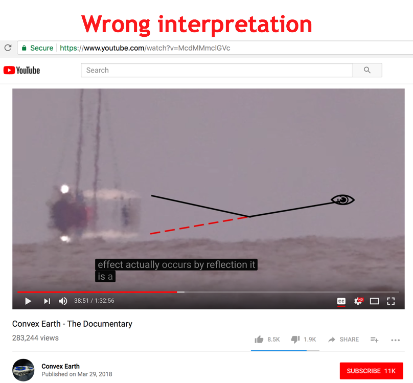
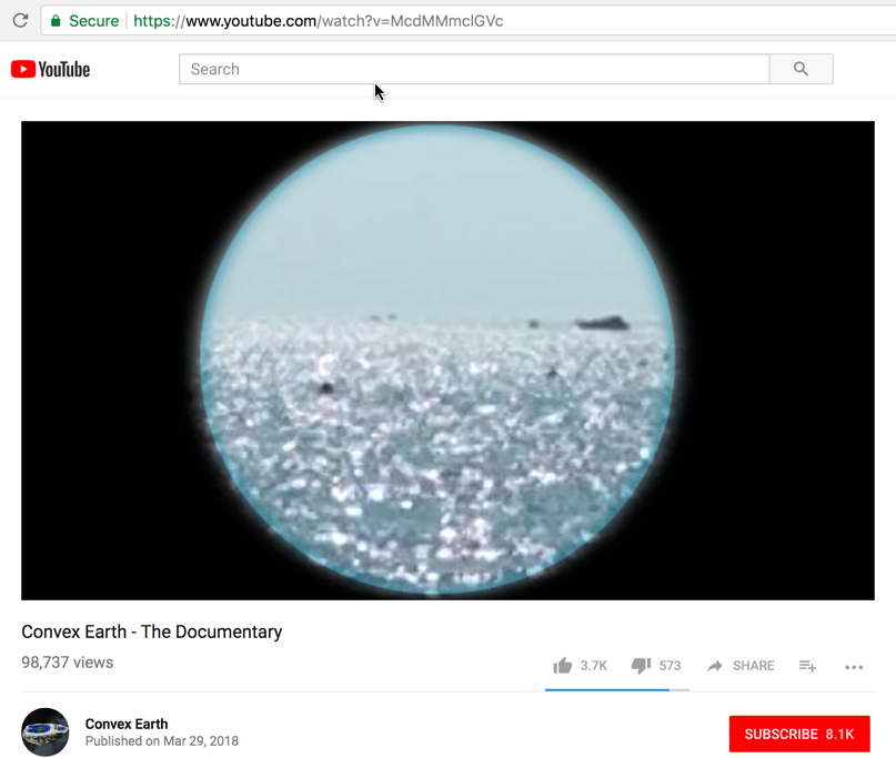
TAKEN BEFORE THE ABOVE PHOTO, as viewed thru a telescope...
The entire boat as if "floating above the water" is the Fata Morgana mirage.
The telescope did not bring the entire boat back into view, as they stated it would.
The Fata Morgana mirage effect was present along with mirroring.
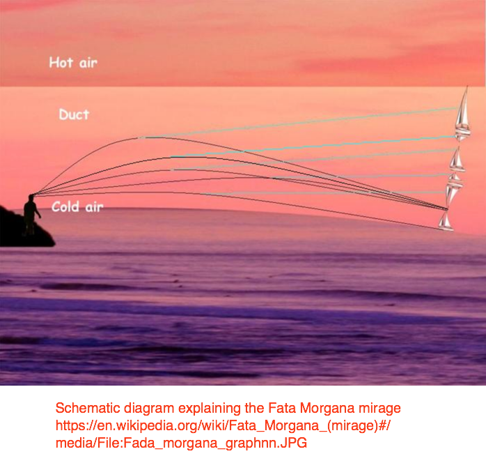
Our correct scientific explanation:
A Fata Morgana is an unusual and complex form of superior mirage that is seen in a narrow band right above the horizon.
To generate the Fata Morgana phenomenon, the thermal inversion has to be strong enough that the curvature of the light rays within the inversion layer is stronger than the curvature of the Earth. Under these conditions, the rays bend and create arcs. An observer needs to be within or below an atmospheric duct in order to be able to see a Fata Morgana.
The video WRONG interpretation..."caused by reflection". Yes, there is mirror line caused sun-water reflection, but when that entire structure is as "floating above the water" as below, that is the Fata Morgana mirage due to thermal atmosphere inversion.
Their new "Theory of Optics Applied to Visual Phenomena" was presented with no scientific analysis, atmospheric study, lens optics, math, or genuine physics proofs.
This is just another attempt to whitewash away observed phenomena due to the Earth's curvature -
a) Why the boats seem to disappear going down the horizon line
b) Why first fade the hull, and then the boat
c) Why when an observer is taller can see farther
To demonstrate the validity of this new theory they just showed once again (at time mark 39:45) the curved Earth proof of boats going over the horizon.
- -
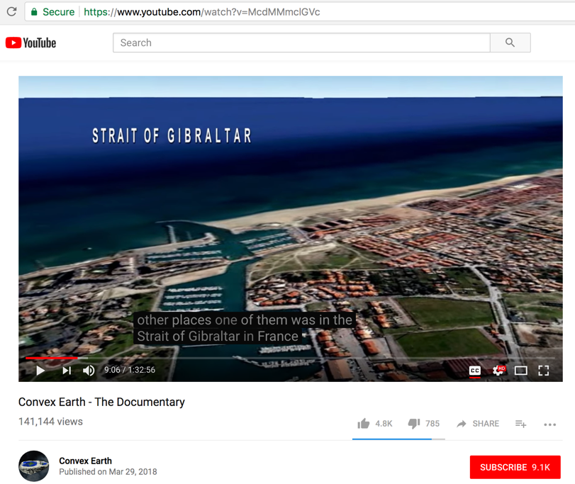
Video says, "This same experiment was carried out in other places. One of them was in the Strait of Gibraltar in France. We are here in the south of France seaside town called la besqueah. We set out together with the French research coordinators of an association called "project energy action" here in France..."
But the last time I checked a map of that area, the narrow Strait of Gibraltar waterway was between (Spain in Europe) and (Morocco in Africa).
The Strait of Gibraltar is not in France, as claimed in this video.
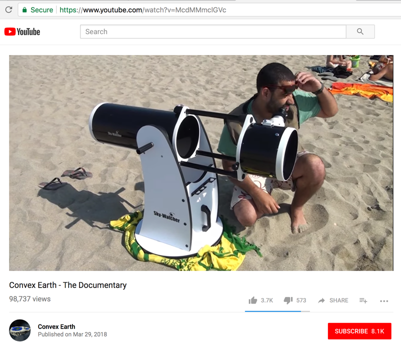
Stated objective: "the filming of a boat as far as possible from the coast." Filmed with a Dobsonian telescope with camera.
- -
Video says, "This same experiment was also carried out in Brazil, at the Três Marias Dam, in Minas Gerais."
-
-
Nice mirage photo of no value...
-
Nice mirage photo of no value...
Video says, "and another team carried out the same experiment on the beach Santos on the coast of Sao Paulo. ... We are zooming in on you."
-
Summary:
So this entire series of tests at...
a) Lagoa dos patos, in Rio Grande de Sul, Brazil
b) Seaside beach in France
c) Três Marias Dam, in Minas Gerais
d) The Santos coast of Sao Paulo
...showed NOTHING to prove that the Earth is concave OR flat.
- - - - - - - - - - - - - - - - - - - - - - - - - - - - - - - - - - - - - - - - - - - - - - - - - - - - - - - - - - - - - - - - - - - - - - - - - - - - - - - - - - - - - - - - - - - - - - - -
Fact check:
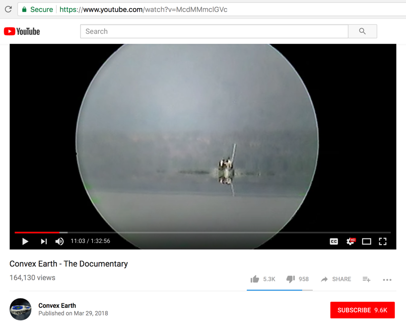
Starting at video time mark 12:02 and 40:18
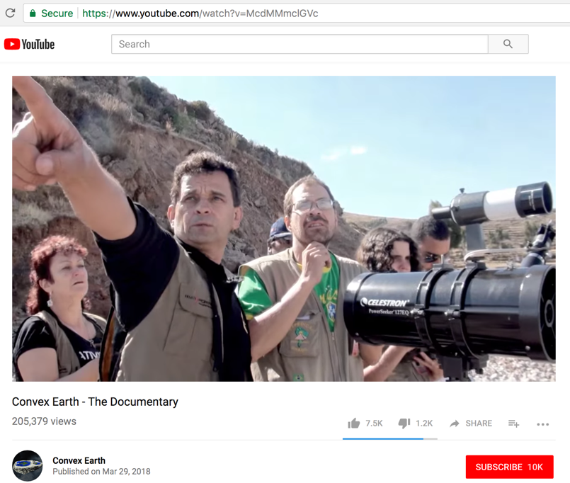
Experiment 2: Long Range Telescope
Note: There is no such thing as a long-range or short-range telescope. A telescope is not limited by distance; only by the apparent angular size of an object and / or its intrinsic brightness.
A two-inch telescope can clearly see the Moon (238,900-miles away) and the bright star Sirius (8.6-light years away).
*
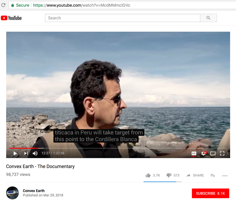
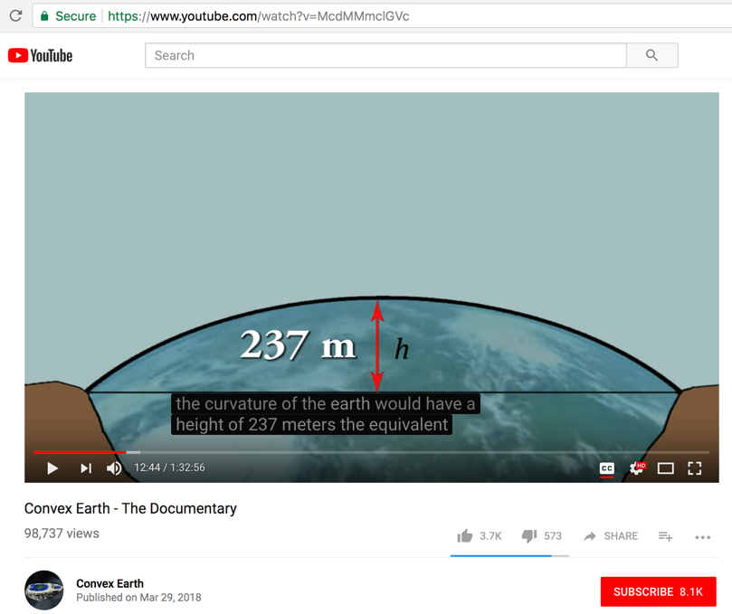
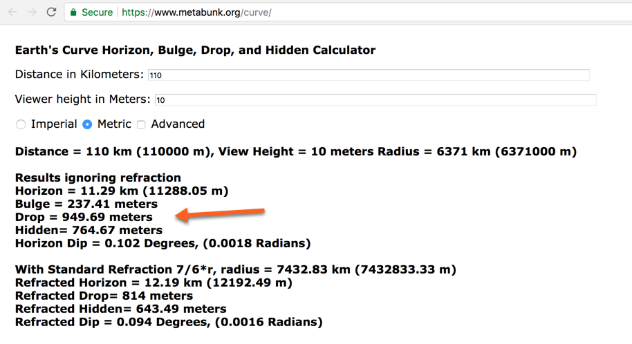
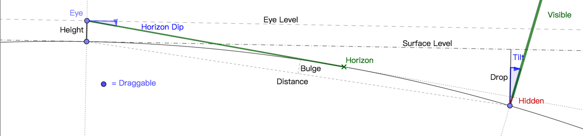
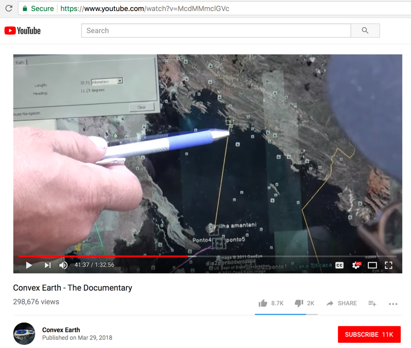
Another experiment was realized at Lake Titicaca in Puru. From Amatani Island they targeted the Cordillera Blanka, which is 110-km away.
At this point in the video there seems to be some confusion about spherical earth parameters in the mind of Urandir Fernandes de Oliveira. He states the curvature of the Earth would have a height of 237-meters.
Actually, that is the "bulge" of the spherical Earth at 110-km distance. That is not the same as what he considers to be the height - which is really the "hidden" amount = 764.67-meters. Any object less than 764.67-meters tall will not be seen at that 110-km distance.
- -
-
-
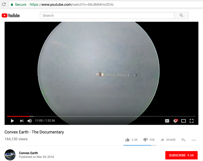
The video asks the question, "will the team be able to see the other shore of the lake through the telescope?"
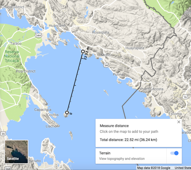
The distance that they point out is not 110-km, it's 22.5-miles or 36.2-km
-
Here on Google Maps we measured 22.52-miles...
-
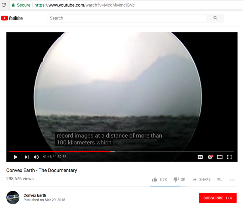
Then they showed the picture below and talk about 100-km.
They believe that if the can see anything at 110-km, even tall mountains, that confirms the Earth is flat. But that conclusion is 100% wrong.
Now if they would have been able to view the shoreline beach at 36.2-km, that would have been proof of flatness. BUT, since the shoreline was hidden by the Earth's curvature it is not to be seen in that photo. Check for yourself.
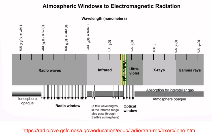
- - - - - - - - - - - - - - - - - - - - - - - - - - - - - - - - - - - - - - - - - - - - - - - - - - - - - - - - - - - - - - - - - - - - - - - - - - - - - - - - - - - - - - - - - - - - - - - -
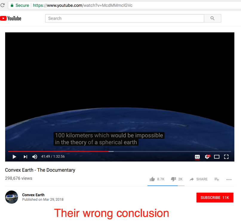
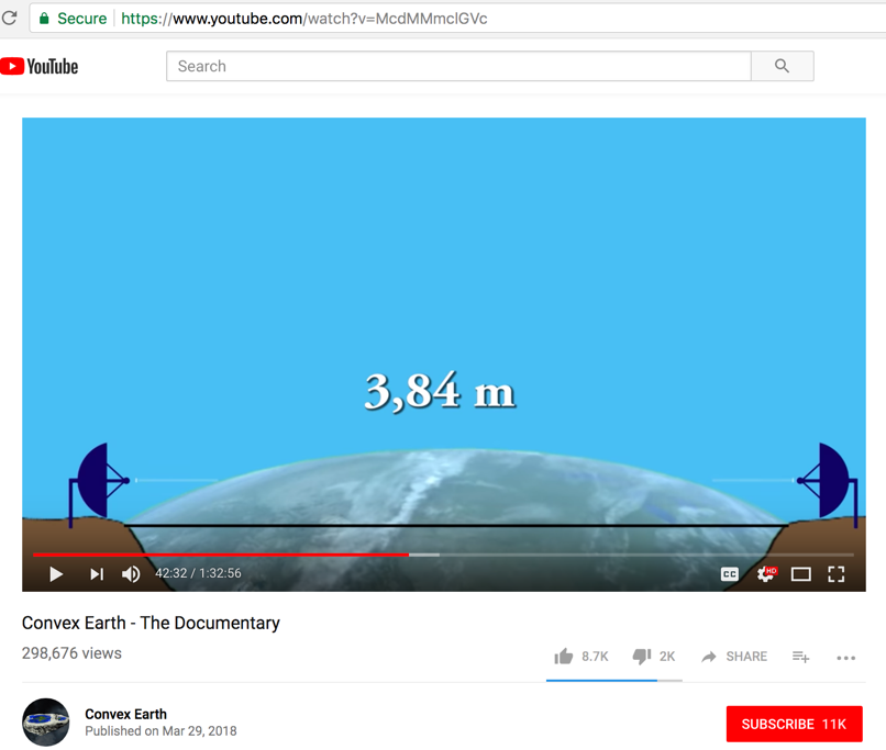
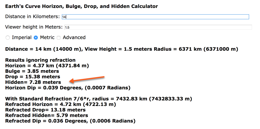
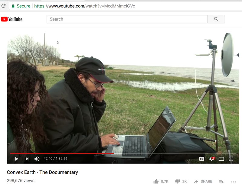
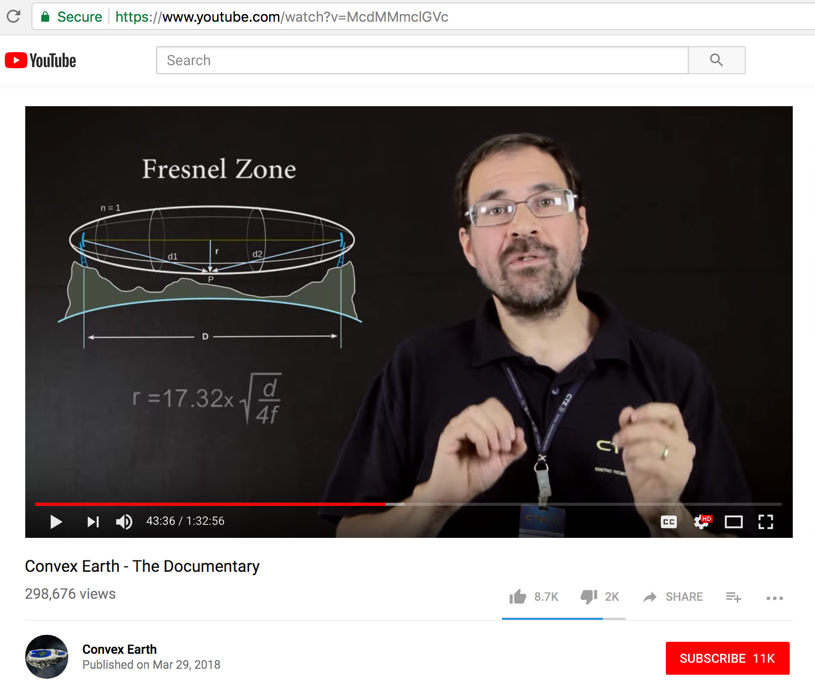
Fact check:
Starting at video time mark 14:25
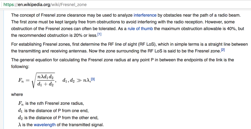
Experiment 3: Radio Waves
Video says "Teams were separated at a distance of 14-km, on opposite sides of the lagoon"
FAIL - The "hidden" spherical Earth curvature amount is 7.28-meters. As explained below the radio transmission beam diameter can become as wide at 13-meters. So only up to 7.28 / 13 = 56% of the beam is obstructed.
So receiving the radio signal from 14-km is well within the range to prove Earth curvature.
Their conclusion is 100% wrong.
-
-
This transmission dish is obviously higher that 1.5-meters above the water line.
-
-
-
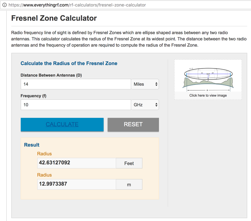
Calculator is here:
https://www.everythingrf.com/rf-calculators/fresnel-zone-calculator
-
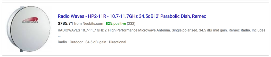
The best of those portable parabolic dishes operate at around 10-GHz

-
- - - - - - - - - - - - - - - - - - - - - - - - - - - - - - - - - - - - - - - - - - - - - - - - - - - - - - - - - - - - - - - - - - - - - - - - - - - - - - - - - - - - - - - - - - - - - - - -
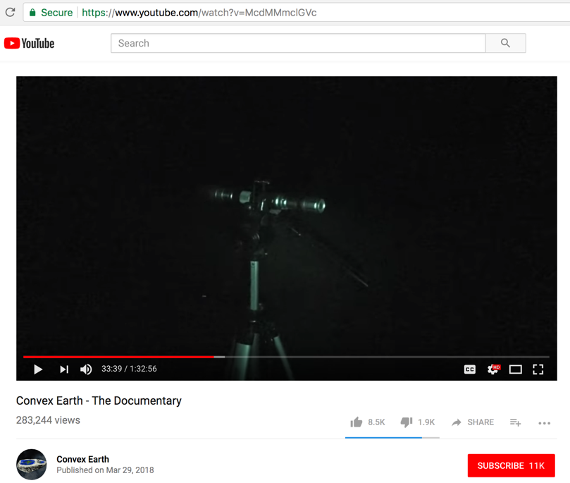
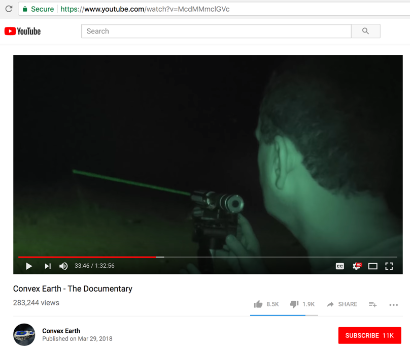
Fact check:
At video time mark 16:10 & 48:28
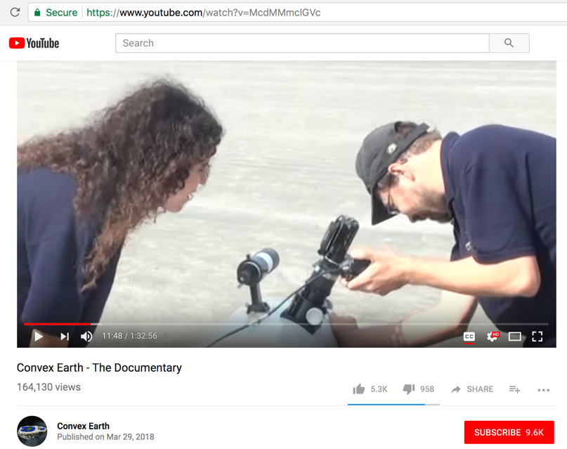
Experiment 4: Laser Beam
Video says "Another performed experiment was to measure the flatness of the water with the use of light."
They built their own laser (shown below). Sao Paulo on the beach of Caraguatatuba, and the second observation point on the beach of Iihabela, 15-km away.
The video statement (at 18:07), "the device emits several beams of light and is set to reach the program distance without expanding,"
...is a physical impossibility. A laser light beam does not remain pencil thin forever, even with collimators. Laser beam DIVERGENCE (spreading out) over distance always occurs.
Laser Divergence Calculator - divergent matters: Beam behavior over distance
https://www.laserworld.com/en/laserworld-toolbox/divergence-calculator.html#divergence
The laser beam visible from the opposite shore (the beach of Iihabela) is not by itself evidence that the Earth is flat. The laser beam must be measured to be parallel to the (1.5-meters) at many points along the 15-km path for that conclusion to have validity. The experimenting team made no such determination.
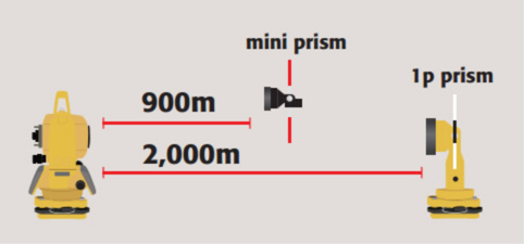
Hooli Peru to beach Copacabana Bolivia - “will the researchers be able to prove the flatness of Lake Titicaca?” - Team about 2-meters above the Lake, we are here (team 2) 1-meter and 35 plus 40-cm from the water level.
No proper measurements shown.
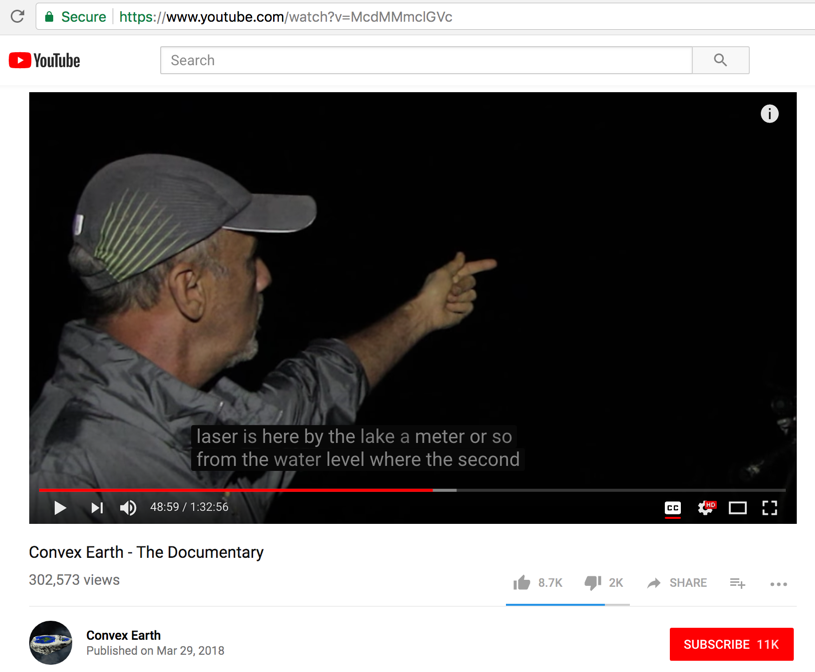
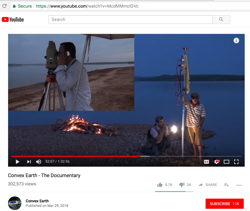
Starting at video time mark 31:39
The researchers return to the Três Marias Dam.
- -
They will test the laser at point B, which is 7.5km from the starting point. Laser is 1.5-meters from the water level.
- -
-
In the first part of this experiment they said 15-km. Now they are saying 18-km.

-
It's seems that "a meter or so from the water level" means the tripod legs are "a meter or so" from where the water meets the shoreline sand.
Unfortunately, the researcher gives an estimate, rather than an exact measurement. No landmarks or azimuths shown.
-
If both observation points are just 4.4-meters above the water's surface, then they will be able to see each other based on the spherical Earth curvature calculation.
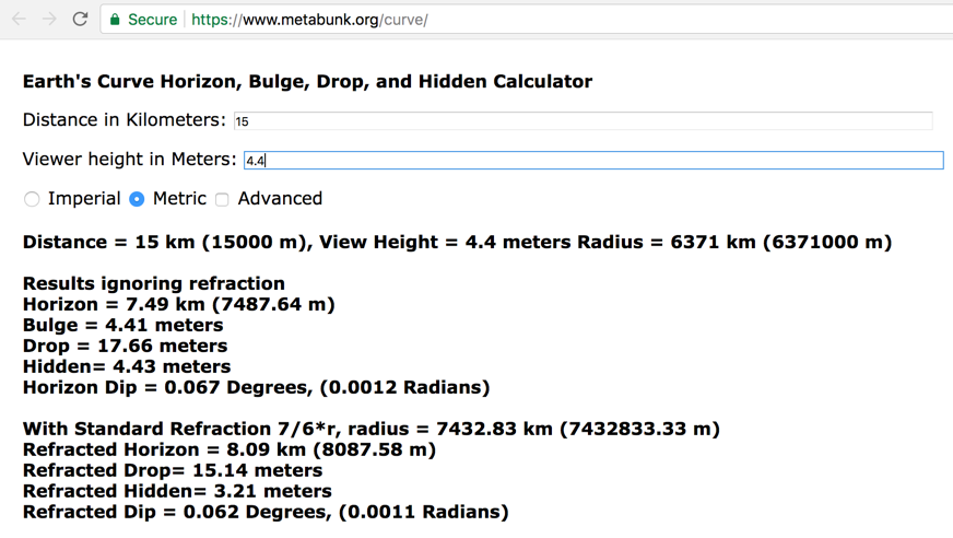
The surprise measurement.
It's obvious from the picture below that the observer with the total station equipment (upper left block) is many meters from the water shore line and many meters above the water level. That unknown information casts doubt on any claim.
The white light (bottom right) was never shown at the receiving point (upper left). Hidden by the Earth's curvature.
-
The teams at Lake Titicaca again, time mark 54:39
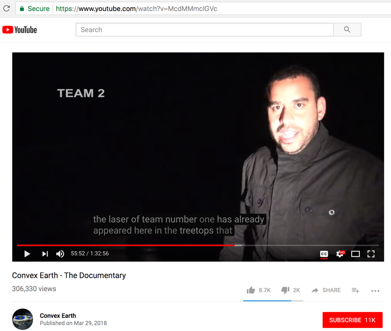
Laser in the tree tops. Since not at ground level - this indicates a spherical Earth.
- - - - - - - - - - - - - - - - - - - - - - - - - - - - - - - - - - - - - - - - - - - - - - - - - - - - - - - - - - - - - - - - - - - - - - - - - - - - - - - - - - - - - - - - - - - - - - - -
Fact check:
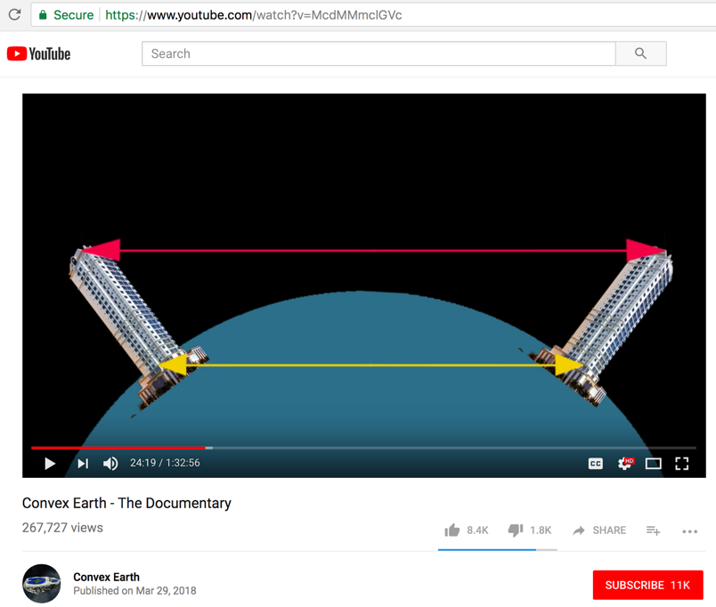
Experiment 5: Geodesic Curvature in Buildings
The entire premise of this experiment, to use GPS to measure a distance disparity between the top and bottom of those two distant buildings, is nonsense.
GPS does not do that.
GPS only measures a static position's latitude, longitude & height.
GPS height is calculated using the standard geoid model, OR if the unit is more sophisticated and can actually receive and anaylze the data from 4 satellites at once, altitude by TRILATERATION can be determined.
Only a commercial laser rangefinder where both buildings are in close proximity (less that 1.5 km apart) can make such a measurement (base-to-base OR top-to-top distance).
As such, GPS cannot determine if those two buildings are leaning toward or away from each other, on a flat Earth or spherical earth (which is what their whole experiment is about).
- -
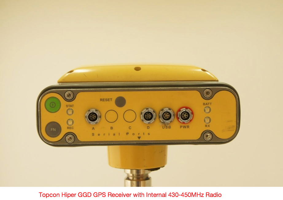
The GPS unit that they used is very old and out-of-date, compared to what is available today ...
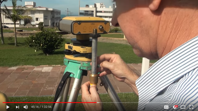
-
Their GPS unit...
- -
A discussion of what laser ranging can and cannot do. Yards, not miles for that hand held device ...
No user manual found on-line for their GPS unit.
- -
Their following experiment PROVES NOTHING...
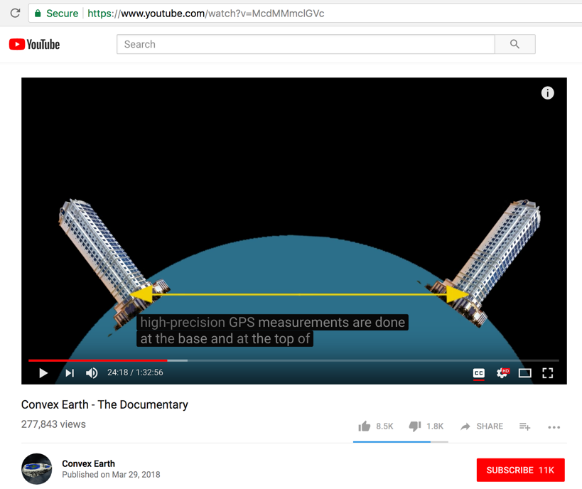
Starting at video time mark 22:47
Video says "Measure the geodesic curvature between two buildings over distance over a long distance using high precision GPS. We take two buildings, one in a city in the south and one in a city in the north."
Two buildings of the same height at sea level.
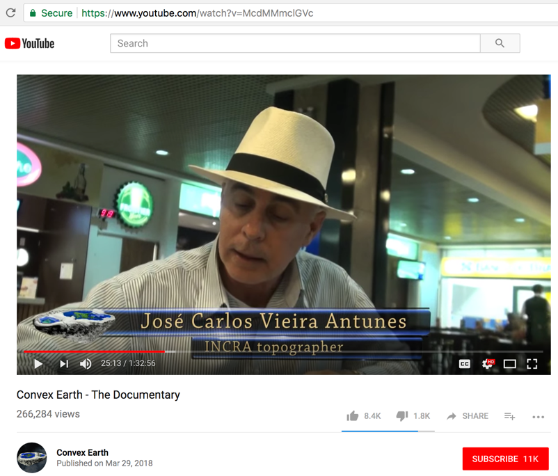
INCRA – the National Institute of Colonization and agrarian reform did the measurements.
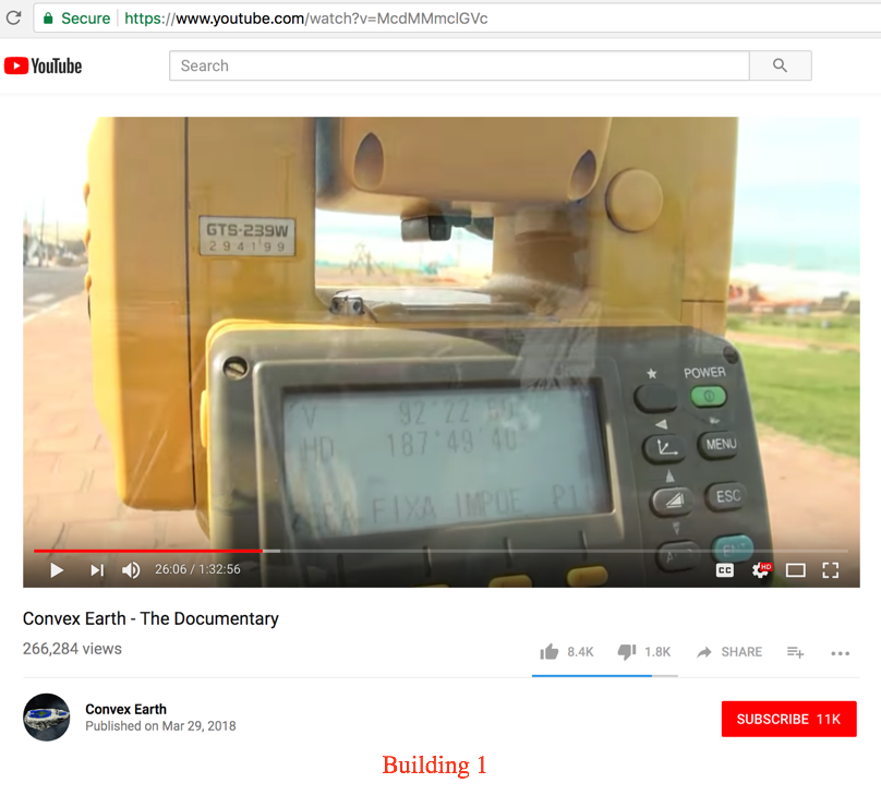
The first building chosen was a Torres beach in Rio Grande do Sul
V 920 22’ 56”
HD 1870 49’ 40’
The fallacy here is that except for the height measurement, the GPS measurement (latitude and longitude) at the bottom and top of each building is the same.
So basically the desired measurement (in red below) cannot be obtained thru GPS or any Total Station surveying instrument.
THIS IS THEIR STATEMENT = "high-precision GPS measurements are done at the base and at the top of each building. According to the theory of the spherical earth the distance of the measurements of the bases must be different than the measurements of the top."
- -
- -
- -
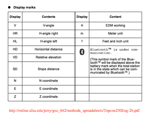
Notice screen measurement of (V - angle) and (HD - horizontal distance)
Electronic Total Station - GTS - 239W Series User Manual
http://online.sfsu.edu/jerry/geo_642/methods_spreadsheets/Topcon230Eng-2b.pdf
- -
- -
This is their Total Station...
- -
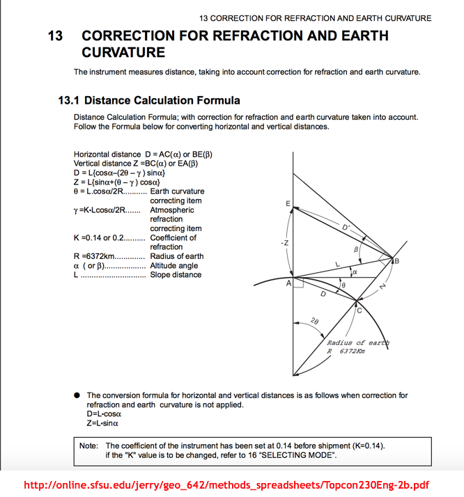
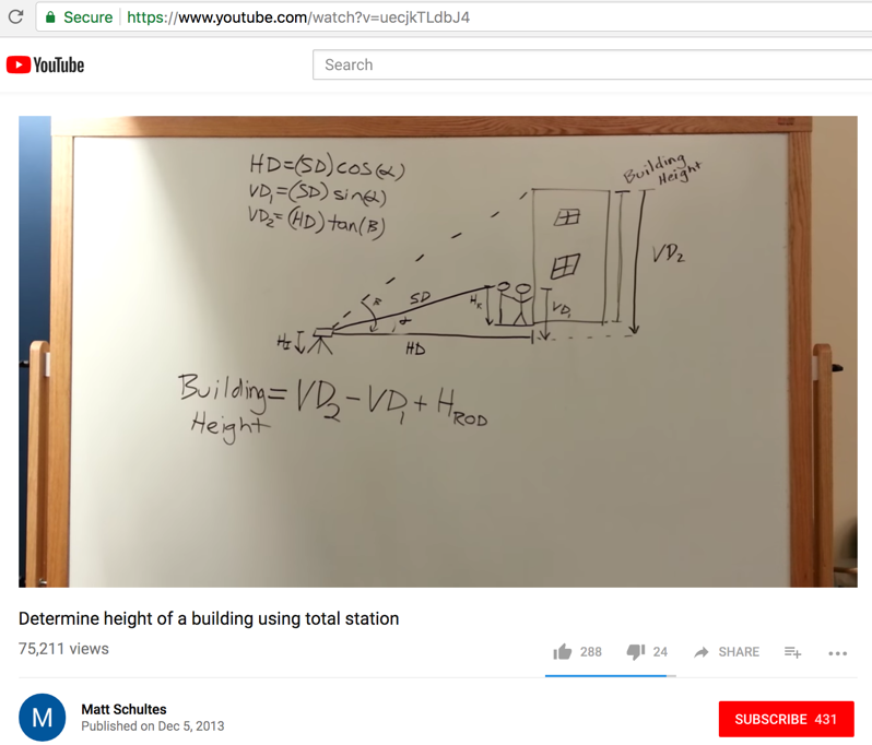
Here is how to determine the height of a building using a Total Station:
The distance to a standard height survey rod (SD) and the base of the building (HD) is needed, along with angular Total Station measurements.
- -
2nd building in Natal, in Rio Grande do Norte
3050-km from each other
GPS L1 L2 signal receiver
later use a total station
time mark - 26:58
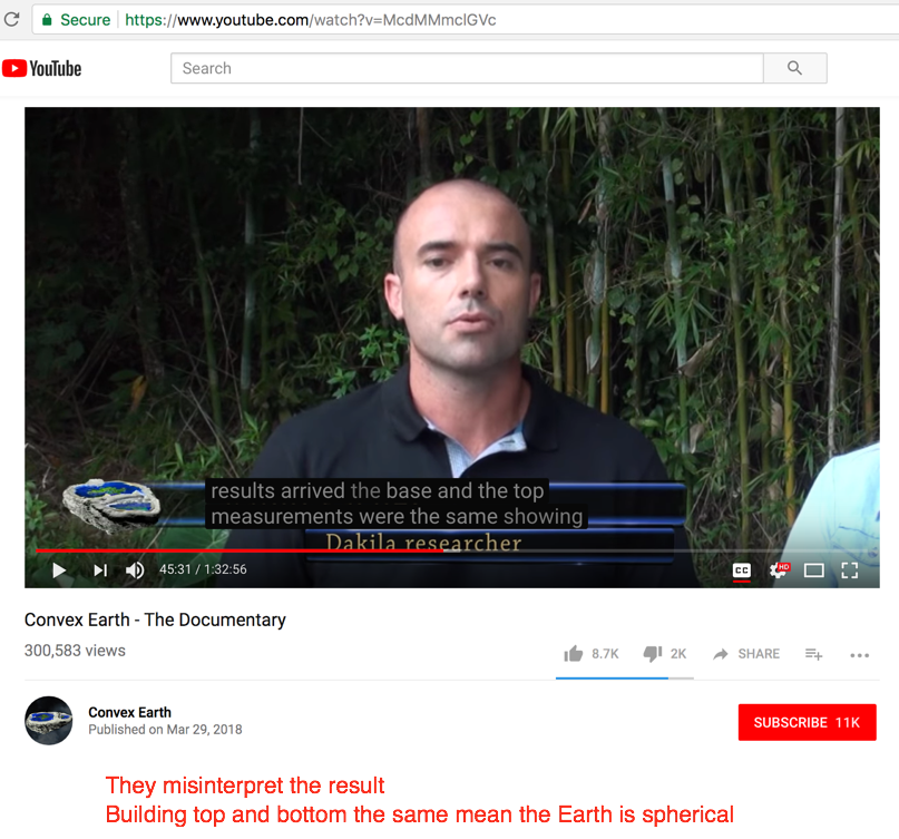
Question posed in the video, "“to what conclusion did INCRA surveyors arrive in relation to the curvature of the Earth?
No answer given at this point
- -
Staring at time mark 44:10
They show none of the measurement data. That is not the scientific verifiable way.
How did they determine the (base-to-base) and (top-to-top) distance, when GPS only delivers latitude, longitude, and height above sea level - only for the exact measuring point?
They did not measure a top-to-top distance since that is not possible with their equipment. Unfortunately, they are lying.
Building top and bottom the same (GPS latitude & longitude) indicates that the Earth is spherical, as shown how above.
- -
Here is a summary of the equipment parts they are using.
Here is what they show at the top of the building. It's only a Total Station "reflecting prism" targeted from the ground. So they are measuring only the "building height". Absolutely nothing more.
The only current way to measure if two building are parallel to each other, is if both buildings are within range of Total Station at measurement time. Since the buildings are separated by 3050-km, that wat possible.
Their claim to be able to measure building sway is a lie. It's not possible to do that with their current equipment.
- - - - - - - - - - - - - - - - - - - - - - - - - - - - - - - - - - - - - - - - - - - - - - - - - - - - - - - - - - - - - - - - - - - - - - - - - - - - - - - - - - - - - - - - - - - - - - - -
Fact check:
Starting at video time mark 1:10:58,
Commentary: And the Satellites?
Video says, "the magnetic field of our planet is primarily responsible for keeping the satellites in orbit."
That is nonsense. Most of the component parts of a satellite are not even magnetic.
The Earth's magnetic field (something measured very thoroughly around the word) does not have the strength to support and object above the Earth...
The following is physical fantasy...
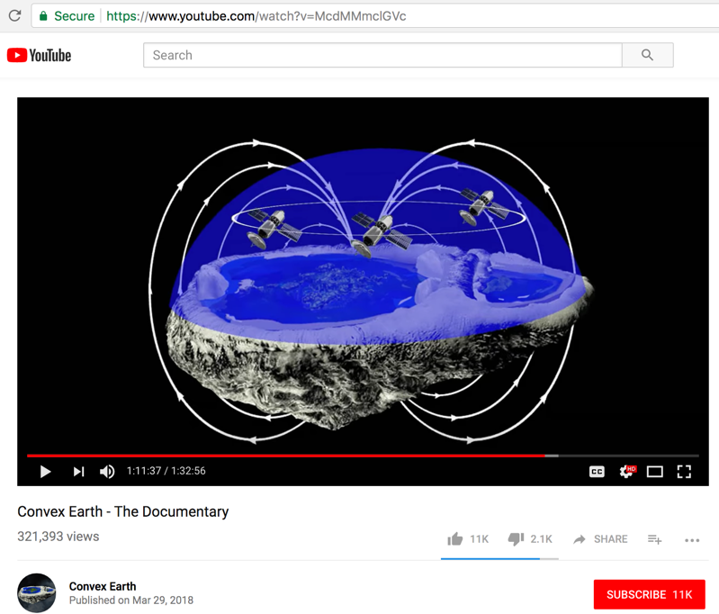
The Earth's magnetic field strength diminishes in proportion to the inverse square of the distance from the surface.
A frog can be levitated a foot or so with a 16 Tesla magnetic field. The water in the frog's body responds to the magnetic field. The Earth's magnetic field strength at its surface is about 50-microteslas (0.00005 Tesla).
That means the force needed to levitate the frog is 320,000 times the Earth's present magnetic field.
So levitating a 10,000-pound satellite (an average one) and keeping it in orbit say 250-miles above the Earth's surface, requires mega-teslas of field strength. That is not our reality.
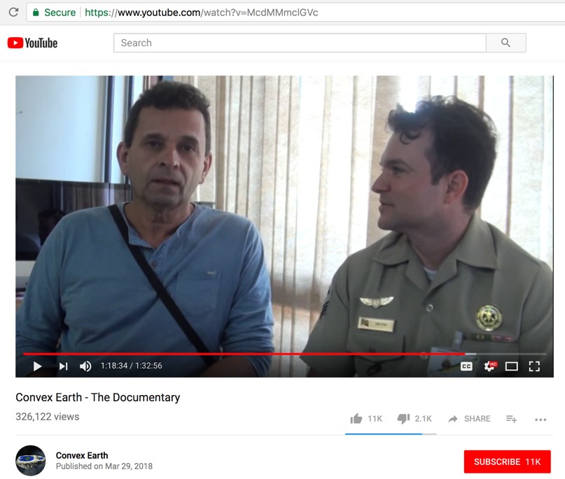
We are not sure if the following person in uniform is really a member of the Brazil Navy as stated in the video, but that government has a great interest in promoting satellites - as mentioned in the CNBC article a bit below.
What's also very interesting is that ALL OTHER flat Earth supporters insist that satellites are fake and do not exist. Yet these folks here due push the existence of satellite and have tailored their Convex Earth magnetic theory to account for them.
Does this mean that the government of Brazil stepped in and pressured Urandir Fernandes de Oliveira to allow for satellites, so that NASA would spend their dollars there?
Just a thought to consider.
The key to cheaper US rocket launches may sit in Brazil's jungle
https://www.cnbc.com/2018/03/19/brazils-alcantara-why-are-boeing-lockheed-martin-vector-interested.html
Three U.S. space companies are interested in launching from an old rocket complex on Brazil's Atlantic coast.
The most obvious market is for launching large satellites into geosynchronous orbits, astrophysicist Jonathan McDowell told CNBC.
But small-rocket builder Vector also sees a market for launching small satellites into equatorial low-Earth orbit from Alcantara.
- - - - - - - - - - - - - - - - - - - - - - - - - - - - - - - - - - - - - - - - - - - - - - - - - - - - - - - - - - - - - - - - - - - - - - - - - - - - - - - - - - - - - - - - - - - - - - - -
Fact check:
At video time mark 28:23 & 46:14
Experiment 6: Geodesic Curvature in Water
Location of test - at the Três Marias Dam, in Minas Gerais, Brazil. Reservoir of the Traymore hydroelectric plant. 18-km water stretch available.
Video says, "we are going to start the verification of the horizontality of the water here in the reservoir. It is a large reservoir. We are in a stretch that will give us up to 18-km. The test aims, in other words the following, the dam has a certain level. If the level GPS measures give the same this means that there is no curvature of the earth. If the measurements are different then this means that there really an earth curvature in relation to sea level."
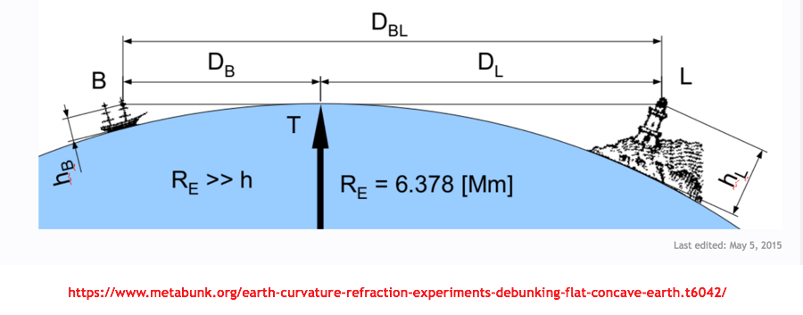
The statement above in wrong. As shown in the diagram below, both the boat and lighthouse are the same distance Re from the center of the Earth. Therefore, GPS measurements at BOTH locations will show the same elevation above sea level. Both measurements the same = prove a spherical Earth.
At point B, 7.5km from the starting point, there 556-meters altitude on the lagoon level. All three points measured 556-meters altitude.
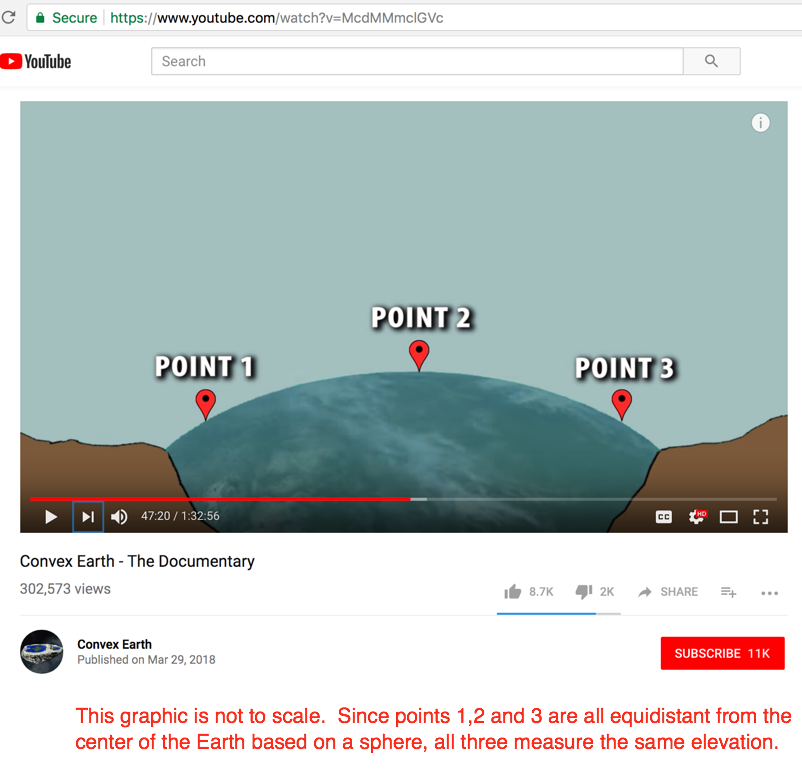
Thank you for verifying that the Earth is spherical!
- - - - - - - - - - - - - - - - - - - - - - - - - - - - - - - - - - - - - - - - - - - - - - - - - - - - - - - - - - - - - - - - - - - - - - - - - - - - - - - - - - - - - - - - - - - - - - - -
Fact check:
An observation to think about.
This documentary represents the (Dakila Research and Zigurats Technology Center) research and experiments performed by them over the past 7-years (so they claim). But from a video production standpoint, since none of the researchers shown age at all during the entire video, we may be able to conclude that this whole documentary production was only recently made - and the folks on the beaches with telescopes and equipment just lately staged to portray what was done in the past.
According to (https://en.wikipedia.org/wiki/Ziggurat)…
A ziggurat is a type of massive stone structure built in ancient Mesopotamia. It has the form of a terraced compound of successively receding stories or levels.
Notable ziggurats include the Great Ziggurat of Ur near Nasiriyah, the Ziggurat of Aqar Quf near Baghdad, the now destroyed Etemenanki in Babylon, Chogha Zanbil in Khūzestān and Sialk.
- - - - - - - - - - - - - - - - - - - - - - - - - - - - - - - - - - - - - - - - - - - - - - - - - - - - - - - - - - - - - - - - - - - - - - - - - - - - - - - - - - - - - - - - - - - - - - - -
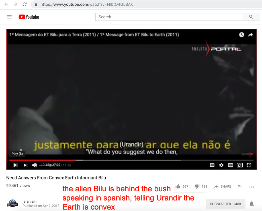
Fact check:
The alien BILU told them that the Earth was convex and they needed to do those experiments to prove it to the public.
BILU also says that the Moon is an optical illusion.
The Convex Earth FRAID EXPOSED - Scientist talks to Alien in bush
https://www.youtube.com/watch?v=TC9jeVT2OPU
- - - - - - - - - - - - - - - - - - - - - - - - - - - - - - - - - - - - - - - - - - - - - - - - - - - - - - - - - - - - - - - - - - - - - - - - - - - - - - - - - - - - - - - - - - - - - - - -
Fact check:
At video time mark 58:17
Commentary: Gravity
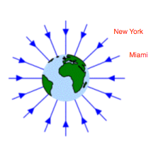
Water does find its level. If you took the experimental equipment shown below anywhere on the Earth, the red water would still look the same.
However, you have missed the point.
When standing say in New York City (latitude = 40.7o N) and then again in Miami Florida (latitude = 25.8o N), yes, those water tubes will all be level as shown. BUT – due to the curvature of the Earth those water levels will be tilted (40.7 – 25.8 = 14.9) degrees with respect to each other.
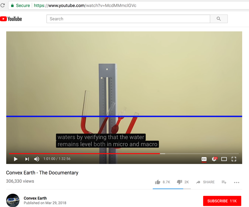
Like this...
The research group then goes on to say, that these are the four fundamental forces that maintain harmony on a non-spherical planet:
magnetism
density
pressure
light
HOWEVER, both density and pressure are dependent upon the force of gravity...
-
... so GRAVITY is still part of the equation.
There are just too many errors to count in this section of the video, where the properties of THEIR four fundamental forces are described.
For example, ripples in water when you drop a pebble in - is kinetic / momentum energy due to GRAVITY - not magnetism as they claim. They all get an F- in physics.
Urandir de Oliveira is actually nuts at this point in the video. His interpretation of the forces of nature are hallucinatory (time mark 1:03:51).
- - - - - - - - - - - - - - - - - - - - - - - - - - - - - - - - - - - - - - - - - - - - - - - - - - - - - - - - - - - - - - - - - - - - - - - - - - - - - - - - - - - - - - - - - - - - - - - -
Fact check:
At video time mark 1:05:34
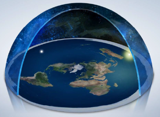
Commentary: If it is not spherical, what is the shape of the Earth?
Urandir de Oliveira says, "any experiment today proves that the globe does not exist. It is impossible"
So there we have it folks - delusion, brain washing, and fantasy at its height.
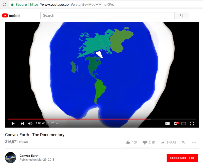
Here is their map of the continents of the Earth, and how they are arranged... Very ridiculous.
- - - - - - - - - - - - - - - - - - - - - - - - - - - - - - - - - - - - - - - - - - - - - - - - - - - - - - - - - - - - - - - - - - - - - - - - - - - - - - - - - - - - - - - - - - - - - - - -
Fact check:
Starting at video time mark 1:11:47,
Commentary: And the photos taken from space?
The video says that the observed curvature of the Earth in space photos is really due to:
1) our atmosphere acting like a large convex lens...
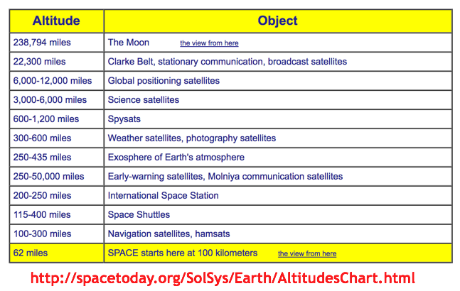
Not true, because thousands of satellites above 62-miles altitude (where the atmosphere ends) have taken pictures that show the Earth is curved. The Kármán line, at 100 km (62 mi), or 1.57% of Earth's radius, is often used as the border between the atmosphere and outer space.
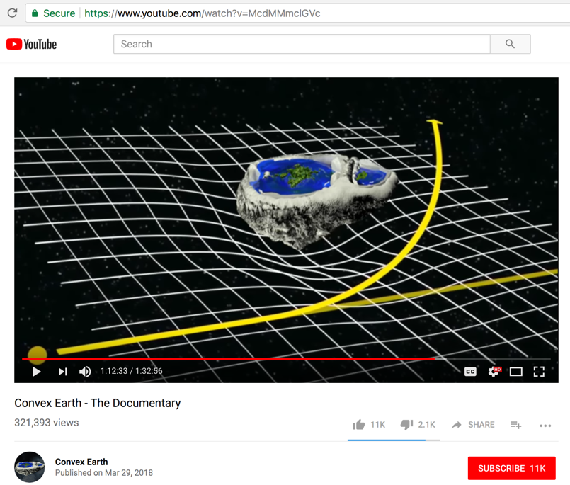
2) the curvature of light by gravity as suggested by Albert Einstein
Not True, because the Earth has nowhere near the amount of mass needed to bend light (gravitational lensing) according to Albert Einstein.
- - - - - - - - - - - - - - - - - - - - - - - - - - - - - - - - - - - - - - - - - - - - - - - - - - - - - - - - - - - - - - - - - - - - - - - - - - - - - - - - - - - - - - - - - - - - - - - -
Fact check:
Starting at video time mark 1:14:00,
Comentary: Models
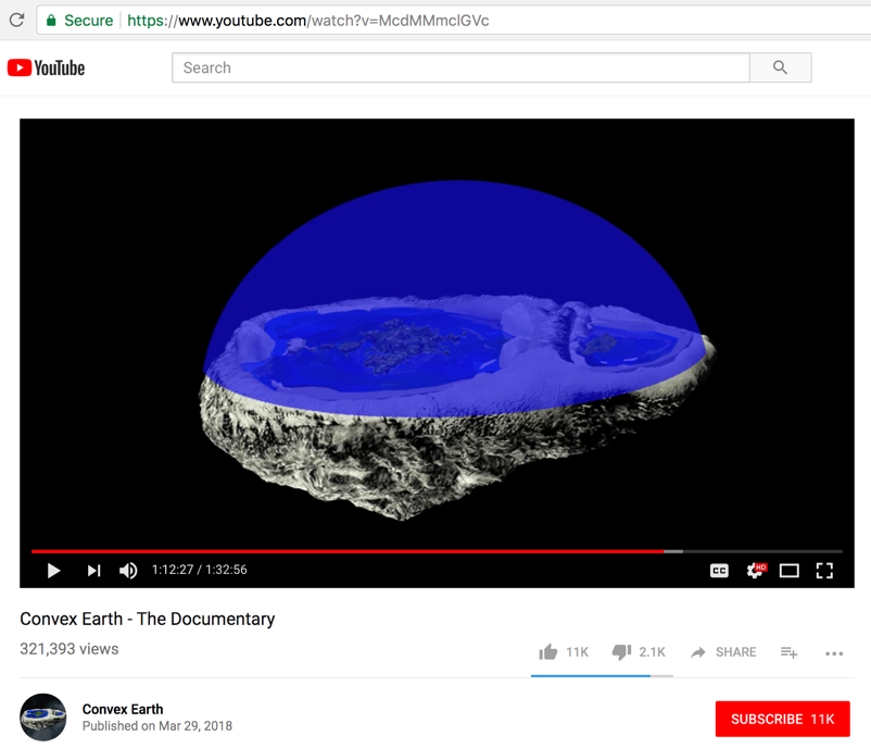
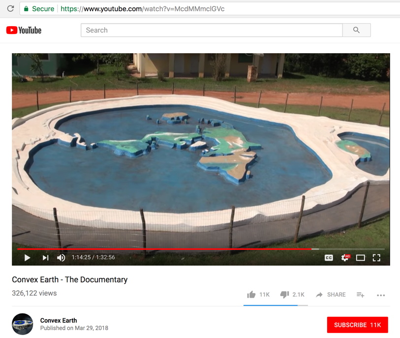
Their following claim at this point in the video is 100% false:
A scale model of their convex Earth. Convex in its continents and level in its waters. The size and shapes of our continents have also been manipulated. All satellite photos of the Earth from space are fake and propaganda.
- - - - - - - - - - - - - - - - - - - - - - - - - - - - - - - - - - - - - - - - - - - - - - - - - - - - - - - - - - - - - - - - - - - - - - - - - - - - - - - - - - - - - - - - - - - - - - - -
Fact check:
Starting at video time mark 1:18:08
Commentary: The New Continent
Here is their new northern continent...
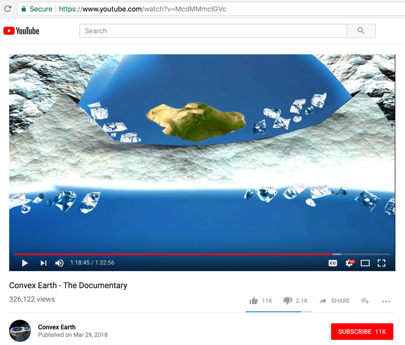
Here is their ONLY PROOF that a new continent exists....
- - - - - - - - - - - - - - - - - - - - - - - - - - - - - - - - - - - - - - - - - - - - - - - - - - - - - - - - - - - - - - - - - - - - - - - - - - - - - - - - - - - - - - - - - - - - - - - -
Fact check:
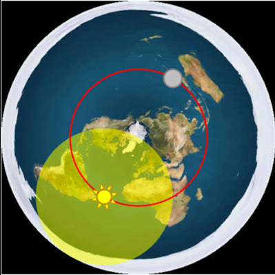
Starting at video time mark 1:20:06,
Commentary: The Solar System
Video says, "The Sun is much closer to the Earth than we think." ... "The Solar System might not even exist." ... "The impression we have of the Moon is that its size varies greatly." ... re: Moon - "it's as if elliptic and in another totally different space out there, as if it were another reality" ... "we determined that the Earth does not spin" ... "
No proof offered for any of these claims. It's just nonsense.
- - - - - - - - - - - - - - - - - - - - - - - - - - - - - - - - - - - - - - - - - - - - - - - - - - - - - - - - - - - - - - - - - - - - - - - - - - - - - - - - - - - - - - - - - - - - - - - -
Published on – March 26, 2018
Discussion at - https://www.youtube.com/channel/UC7ipUKERU0tzYFxALJBli4A/discussion
Video at - https://www.youtube.com/watch?v=McdMMmclGVc
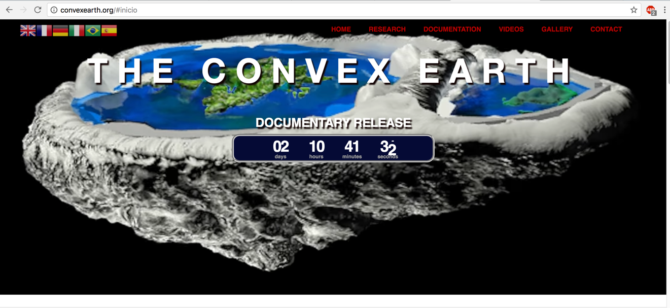
Their website at (by Alessandro Oliveira) - convexearth.org
Our home page all articles -http://flatearthlunacy.com
kind regards, JonahTheScientist
- - - - - - - - - -
- - - - - - - - - -