


Flat Earth NOT - 1931 aerial photographs presented by National Geographic Magazine, and 1936 balloon flight show Earth curvature
Entire Dear readers, THIS POST IS STILL IN PROCESS
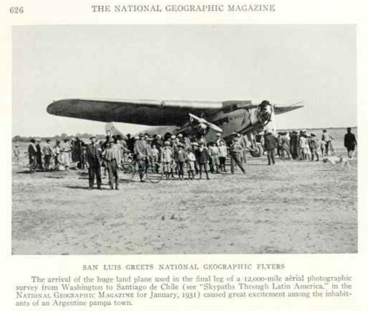
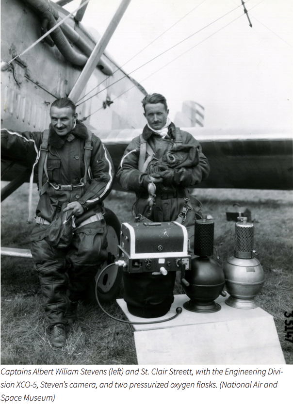
In 1931 National Geographic documented the daring airplane trip made by CAPT. Albert Steven across the skies of South America. He visited many cities during his travel and set aircraft flying records.
Here is Capt. Stevens account of flying the Andes and photographic it - which provided the FIRST EVIDENCE that the Earth is curved, from a vantage point above the Earth's surface.
And remember that 1931 is well before the invention of personal computers and CGI software.
Real photographic film was used for these pictures.
Photographic film is a strip or sheet of transparent plastic film base coated on one side with a gelatin emulsion containing microscopically small light-sensitive silver halide crystals. The sizes and other characteristics of the crystals determine the sensitivity, contrast and resolution of the film.
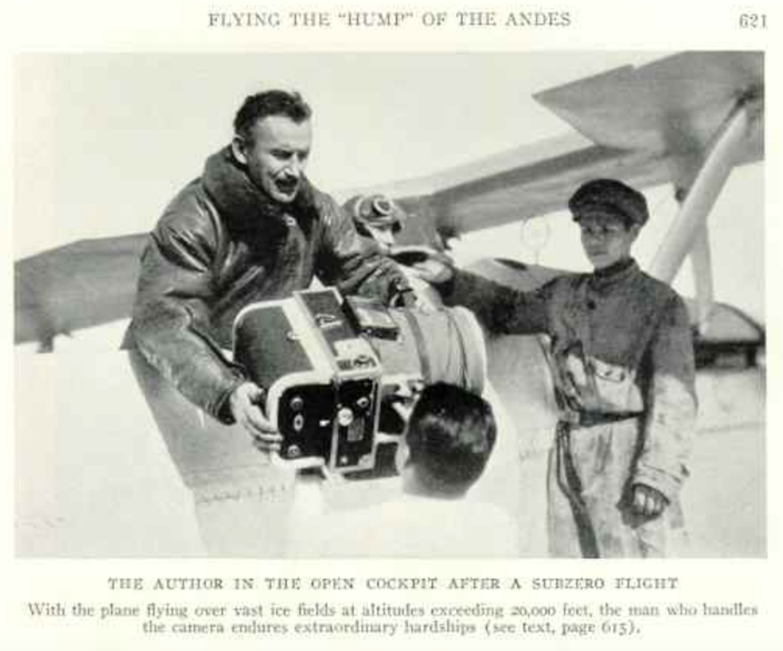
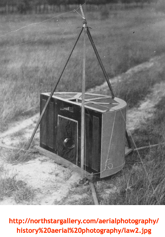
The Fairchild camera that CAPT Stevens used was the aviation standard piece of equipment, adopted after the first World War. See picture below.
Sherman M. Fairchild was born in Oneonta, New York, in April 1896 as the only child of congressman and a founder of International Business Machines (IBM), George W Fairchild. Sherman attended college at Harvard, the University of Arizona, and Columbia, studying engineering and aerial photography (graduating from none of them). In 1917 Fairchild was rejected from the US military because of poor health. Determined to help with the war effort, he and his father went to Washington to see if his experience with cameras might be helpful. At the time, the aerial cameras available to the US Army produced poor quality images because the camera's slow shutter speed could not keep up with the motion created by the airplane.
Fairchild developed a camera with an between-the-lens shutter which produced much clearer images. Even though the Army did not accept his camera until World War I had ended, it acquired two units for training. Fairchild started the Fairchild Aerial Camera Corporation in February 1920 as a vehicle to built and distribute his aerial cameras. Soon after the US Army placed orders for the and made the Fairchild the standard military camera.
Fairchild Aerial Camera Corporation
http://camera-wiki.org/wiki/Fairchild#F-1
- - -
The following text is on page 599…
“Photographing the Andes at 300 miles Distance”
Serenely, I chatted with Thompson while he climbed the plane higher and higher, so that I could make out at regular intervals exposures of the distant range of the Andes.
The day was quite good, and even at 200 miles the Andes could be seen in detail. Higher and higher we rose, passing the 20,000-foot mark. Struggling for the last thousand feet possible with the load we carried. Thompson had the plane titled almost to stalling speed. Fortunately, the west wind at this elevation is quite strong, and we still made excellent time eastward. At 300 miles I could still make out Tupungato, Plata, and Aconcagua, with the town of Villa Mercedes some 30 miles away.
Twenty miles farther on I could see Tupungato and Plata only through a red viewing filter. Later they disappeared altogether, visually, but the camera caught the very tops of the peaks on the last negatives exposed over General Soler Field, as it afterward proved when we developed the film. The filter used on the lens was such a deep red that one could not see through it; yet the film used was so red sensitive that exposures were secured in a twentieth of a second…
- - -
Entire edition at - http://freeshopmanual.com/downloads.php?cat_id=34&rowstart=30
- -
- -
The Fairchild camera was electrically heated...
- -
- -
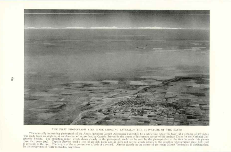
THE FIRST PHOTOGRAPH EVER MADE SHOWING LATERALLY THE CURVATURE OF THE EARTH
This unusually interesting photo of the Andes, including Mount Aconcagua (identified by a white line below the base) at a distance of 287 miles, was made from an airplane, at an elevation of 21,000 feet, by Captain Stevens in the course of his camera survey of the Andean Chain for the National Geographic Society. The mountain range, which clearly in the photograph, could not be seen by the photographer at the time he made this picture (see text page 599). Captain Stevens used a lens of 20-inch focus and an infra-red screen which admits to the sensitive photographic plate light that is invisible to the eye. The length of the exposure was 1/20th of a second. Almost exactly in the center of the range Mount Tupungato is distinguished. In the foreground is Villa Argentina.
- -
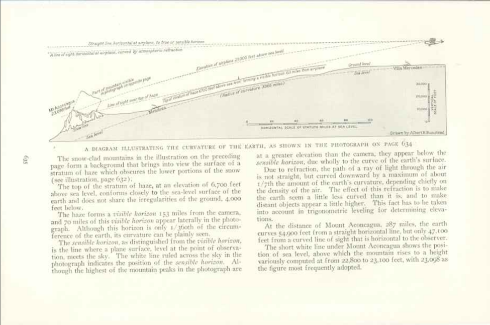
Here is the explanation of the over the horizon (as viewed from ground level) air photograph...
- - -
- - - - - - - - - - - - - - - - - - - - - - - - - - - - - - - - - - - - - - - - - - - - - - - - - - - - - - - - - - - - - - - - - - - -
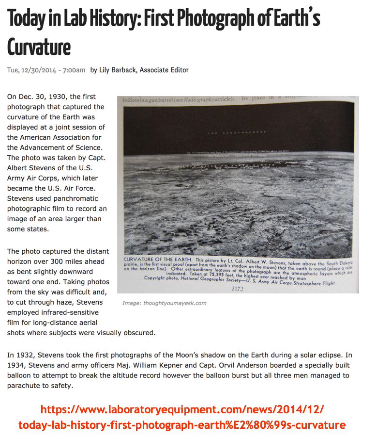
In 1936 Captain Albert W. Stevens made the first photograph that captures the curvature of the earth. It was taken from a balloon at an altitude of 72,000.
At that altitude, the curvature of the Earth is a small = 4.76 degrees. It's hard to notice but it is there in the picture below.
- -
- - -
"From such a great height, Stevens reported they saw mostly patches of green or brown on the ground. Railroads were the only recognizable features, and then only by an occasional cut or fill. Larger farms could be picked out by their rectangular patterns. A new American flag hung from the rigging. The sky above them was a darker blue than that on the flag. They recorded the first photographs that showed the curved top of the troposphere and the curvature of the Earth. Anderson and Stevens calculated they could drop another ton of ballast and gain another 2,000 feet, but decided not to. They had to conserve their remaining ballast to guard against a crash landing."
http://stratocat.com.ar/artics/explorer-e.htm
- - - - - - - - - - - - - - - - - - - - - - - - - - - - - - - - - - - - - - - - - - - - - - - - - - - - - - - - - - - - - - - -
Aeriel advances since then and before the advent of computer / software / CGI etc.
In 1946 the first aerial photographs from space are made using V-2 rockets.
During the 1950's there are many advances in sensor technology to include multi-spectral range and color-infrared photography.
In 1954 the first U-2 begins aerial reconnaissance.
In 1957 Russia launches Sputnik-1.
- -
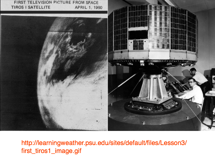
In 1960 TIROS-1 the first meteorological satellite was launched.
- -
During the 1960's, the United States begins collecting intelligence from Earth orbiting satellites, CORONA.
Discussion at - https://www.youtube.com/channel/UC7ipUKERU0tzYFxALJBli4A/discussion
kind regards, JonahTheScientist