


Bonneville Salt Flats prove curvature of the Earth
Dear readers,
The Bonneville Salt Flats in the state of Utah USA is among the longest flat stretches of land found on the Earth. As such, it is an ideal place to test and look for Earth curvature.
So now you can experiment for yourself, and see first-hand, the effect of Earth curvature.
It's all very simple. Just take a drive to Utah. You can directions from wherever you live to the flats here - http://www.stateparks.com/bonneville_salt_flats_state_park_driving_directions.html
Best to take your drive across the Flats early in the morning, right after sunrise. That way the temperature is cooler and there is less heat distortion rising from the salt beds itself.
Understand first how "refraction" and "inferiror / superior mirages" can interfere with your observations. You want to go when there are no mirages present.

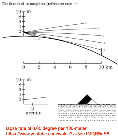
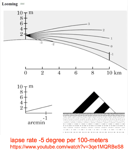
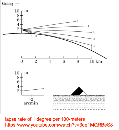
Please notice that no flat Earth supporter has ever put forward a quantifiable model to explain atmospheric refraction.
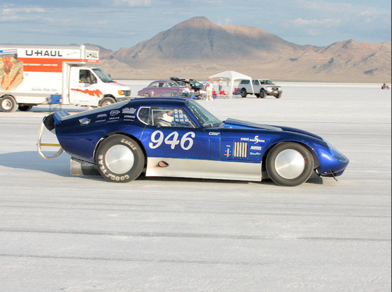
Once there, go the speedway track starting line. Take a picture of any car parked there. Then head out over the track. At about 3 + miles away look back, and you will notice that all those cars and structures at the starting line are no longer visible.
Take a pair of binoculars or a small telescope with you on that trip. So that you can look back and verify that all is gone - hidden beneath the curvature of the Earth.
And you need to make sure you travel the entire 10-miles of the track. Then look back, once again at "starting line," (which is not visible).
Congratulations! You have now proved to yourself that you live on a globe curved Earth.
- - -
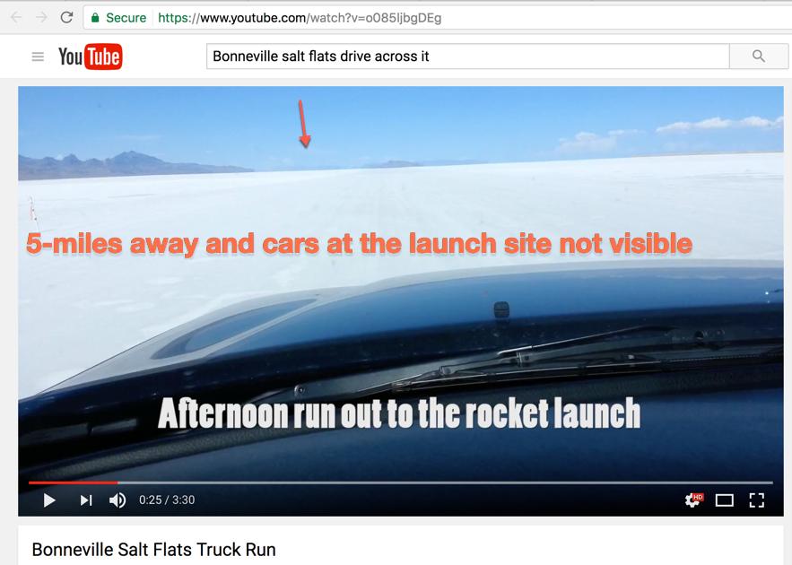
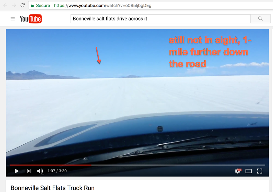
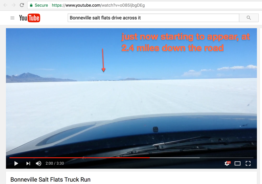
Shown here is a 5-mile run across the Flats to the amateur rocket sit. Truck is traveling at 90 mph, 132 feet/sec, for a total distance of 26,928 feet or 5.1 miles.
Drive 10-miles instead and the effect of curvature is seen even more starkly.
Photo 1
- - -
Photo 2
- - -
Photo 3
- - -
Photo 4
Now 3.9-miles down the road...
- - -
Photo 5
Now 5.1-miles down the road...
- - - - - - - - - - - - - - - - - - - - - - - - - - - - - - - - - - - - - - - - - - - - - - - - - - - - - - - - - - - - - - - - - - - - - - - - - - - - - - - - - - - - - - - -
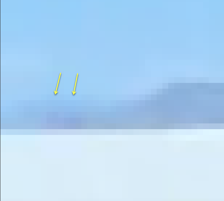
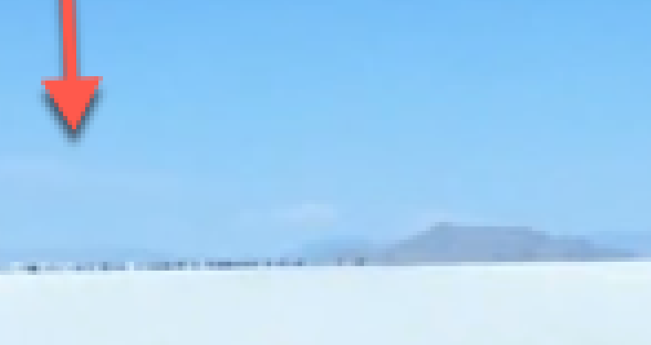
Photo 1 - Expanded (zoom in) pixelated view shows no cars in this photo. All vehicles are still over the horizon and not visible. Distance is 5.1-miles to target.

- - - - - - - - - - - - - - - - - - - - - - - - - - - - - - - - - - - - - - - - - - - - - - - - - - - - - - - - - - - - - - - - - - - - - - - - - - - - - - - - - - - - - - - -
Photo 2 - Expanded (zoom in) view shows faint car pixels in the photo. Distance is 4-miles to target.

- - - - - - - - - - - - - - - - - - - - - - - - - - - - - - - - - - - - - - - - - - - - - - - - - - - - - - - - - - - - - - - - - - - - - - - - - - - - - - - - - - - - - - - -
Photo 3 - Distance is 2.6-miles to target

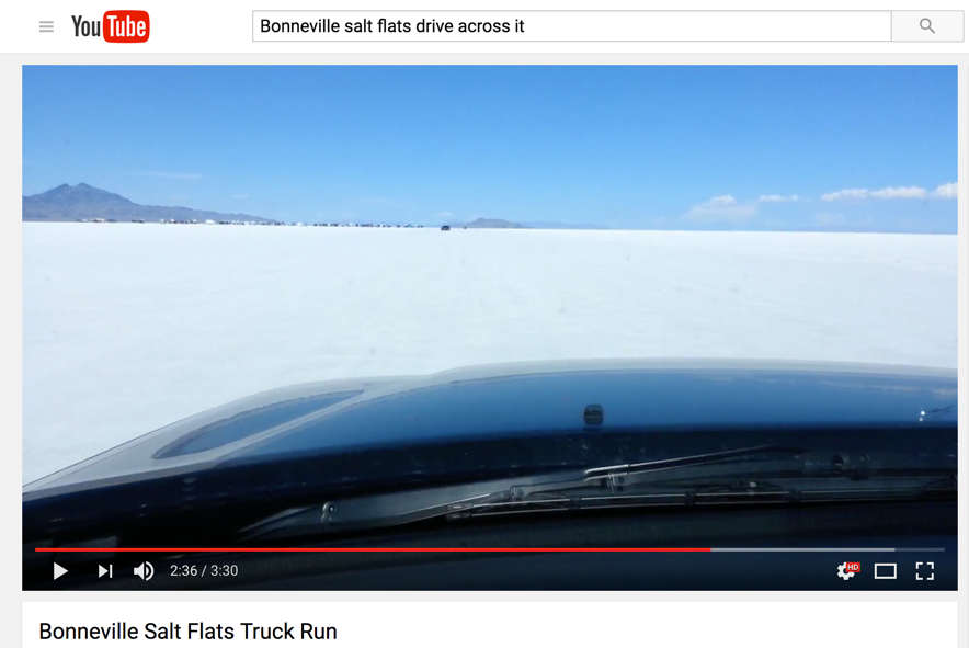
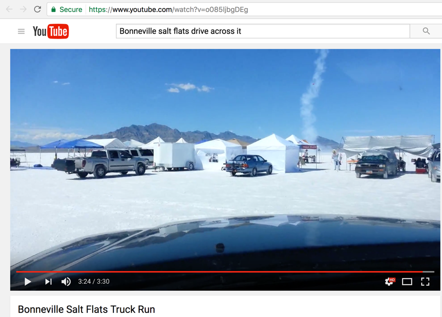
Video at - https://www.youtube.com/watch?v=o085ljbgDEg
- - -
Refer to this article as to why this is not perspective...
http://flatearthlunacy.com/index.php/2-uncategorised/309-why-not-perspective
Here is some other interesting information:
The Bonneville Salt Flats is a densely packed salt pan in Tooele County in northwestern Utah. The area is a remnant of the Pleistocene Lake Bonneville and is the largest of many salt flats located west of the Great Salt Lake. The property is public land managed by the Bureau of Land Management and is known for land speed records at the "Bonneville Speedway". Access is free and visitors can drive on the flats.
Bonneville Land Speed Racing is a unique sport that consists of very determined people who drive hot rods, roadsters, belly tankers, lakesters, motorcycles, streamliners, and even diesel trucks to "shoot the salt" in a simple quest to have their name added to the list of many record holders. Many years ago, the Bonneville Nationals Inc. (BNI) was formed. It's main focus would be to produce the annual "Bonneville Speed Week".
The BNI hosts a spectacular week of racing each year in August, which is the highlight event of the LSR season.
Speed Week consists of six days of racing (Sat - Fri), weather and conditions permitting. Entrants come from all over the world to participate in the week-long event. Spectators are allowed to walk through the pits, view the vehicles, and talk to the drivers and crew members.
- - -
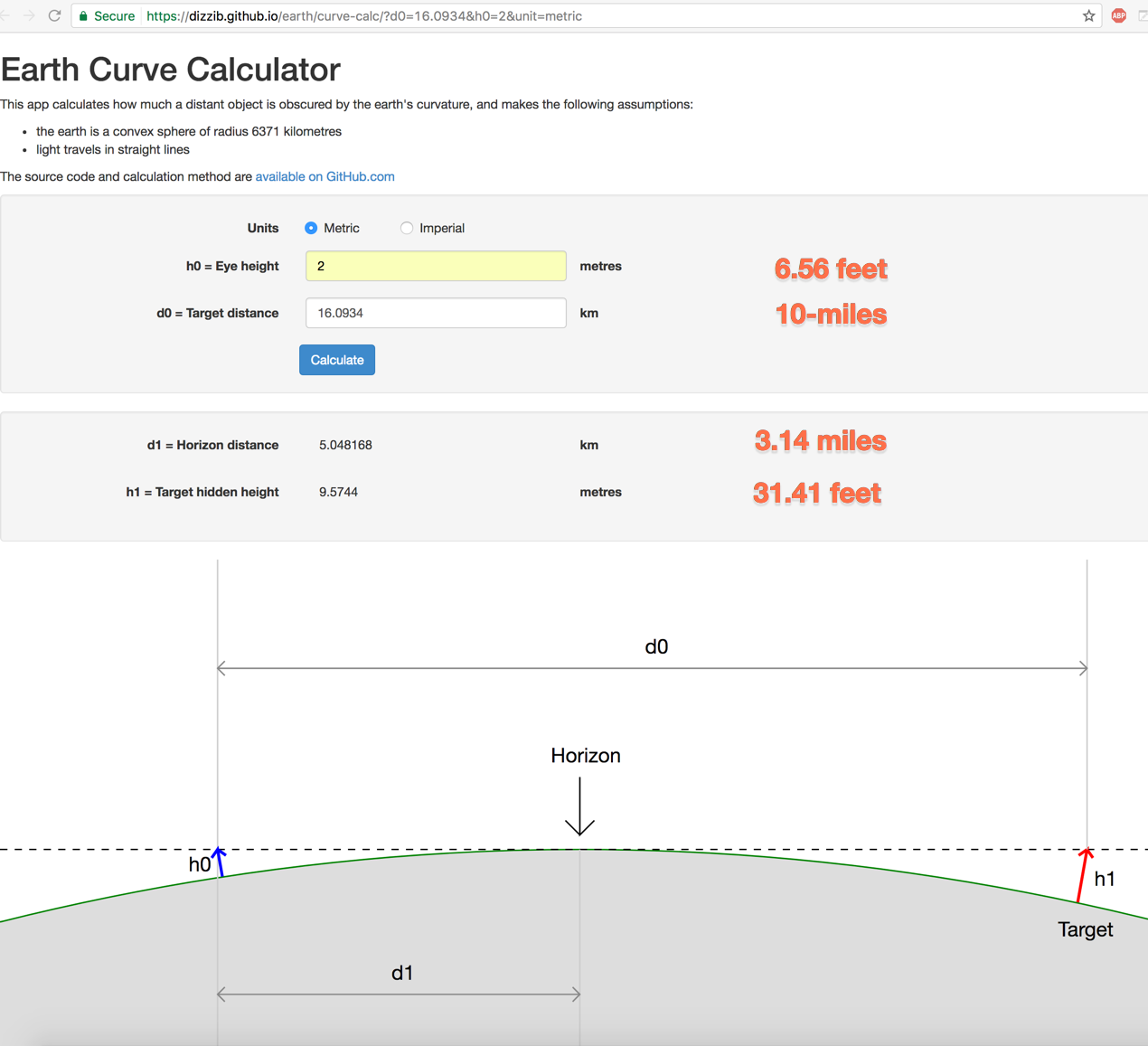
As the calculations below show for our globe Earth, from a 6.56 feet height above the salt surface at the speedway starting line, the horizon is 3.14-miles away. They cannot see any of the salt flat further than that, even with a pair of binoculars or a telescope.
- - -
This same experiment can be performed in any of the following globe Earth salt flats:
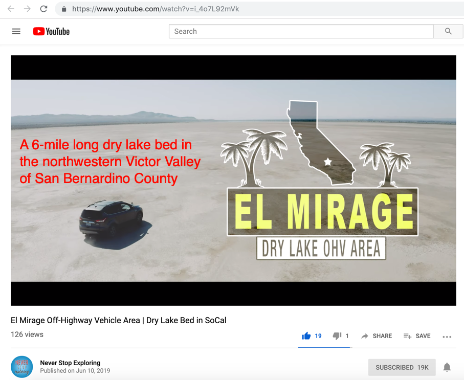
El Mirage
located in the Mojave Desert on the western edge of San Bernardino County.
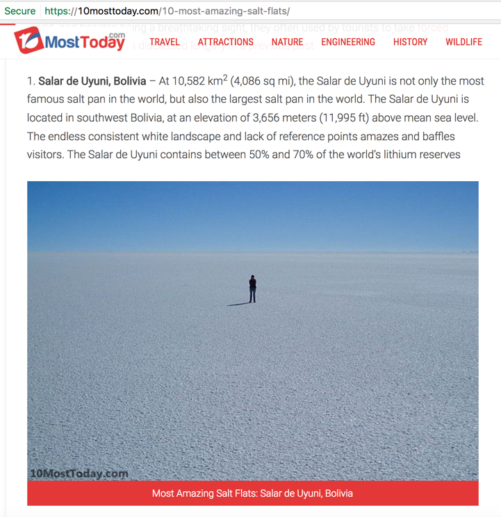
Salar de Uyuni, Bolivia:
At 10,582 km2 (4,086 sq mi), the Salar de Uyuni is not only the most famous salt pan in the world, but also the largest salt pan in the world. The Salar de Uyuni is located in southwest Bolivia, at an elevation of 3,656 meters (11,995 ft) above mean sea level. The endless consistent white landscape and lack of reference points amazes and baffles visitors. The Salar de Uyuni contains between 50% and 70% of the world’s lithium reserves.
Etosha pan, Namibia:
Etosha means ‘Great White Place’ and the 4,800 km2 (1850 sq miles) area is indeed a huge white land. The huge salt pan is a dry lakebed in the north of Namibia, part of the Etosha National Park, one of Namibia’s largest wildlife parks.
Devil’s Golf Course, Death Valley National Park, United States:
Devil’s Golf Course the largest salt pan in the United States. It is located within the world famous Death Valley National Park, in California. The large salt pan got its colorful name from a line in the 1934 guide book of the National Park Service, that stated that “only the devil could play golf” on the rough terrain. The salt pan was once a lake that evaporated, and the minerals from the lake remain on the surface. According to researches, the salt layer is over 1,000 feet (300 m) and in places it could reach up to 9,000 feet (2,700 m).
Salinas Grandes, Argentina:
The Salinas Grandes is the largest salt pan in Argentina and the second largest salt pan in the world, after Salar de Uyuni. The large salt pan covers an area of 6,000 km2 (2,300 sq mi). It is located in central-northern part of the country, at the foot of the Sierras de Córdoba mountain range.
Makgadikgadi Pan, Botswana:
The Makgadikgadi Pan is one of the largest salt flats in the world. This salt pan was once a huge lake, which dried up several thousand years ago and left a large salt desert behind it. Technically speaking, the Makgadikgadi pan is not a single salt pan but rather many pans with desert sand between them. Most of the year the area is entirely dry and covered with a salty clay crust, but when it rains, water can accumulate on the surface and attract wildlife.
Salar de Arizaro, Argentina:
Salar de Arizaro is a large salt flat in Argentina covering an area of 1,600 km² (617 sq mi). It is the second largest salt flat in the country after the Salinas Grandes. It is located in the Andes mountain range, north-western Argentina, near the border with Chile. The Cono de Arita is a 122 meters (400 ft) tall volcanic pyramid, that was once thought to have been man-made. According to archaeological remains found in the cone, the place was a ceremonial center before the arrival of the Incas.
Salar de Atacama, Chile:
Salar de Atacama is the largest salt flat in Chile, and third largest in the world (after Salar de Uyuni and Salinas Grandes), covering a land of 3,000 km2 (1,200 sq mi). This salt flat is located at a very high altitude of around 2,300 meters (7500 ft) above sea level. The Laguna Cejar is a small lake in the middle of the Salar de Atacama, and has a salt concentration high enough to allow a floating effect , similar to the Dead Sea in Israel and Jordan.
Namak Lake, Iran:
Namak Lake is a salt lake located near the city of Qom. The surface of the lake is 1800 km² (700 sq mi) but it is almost entirely dry, with only about 1 km² (0.38 sq mi) with water, which has a depth of less than 1 meter (3.2 ft)
Published on - June 1, 2017
Discussion at - https://www.youtube.com/channel/UC7ipUKERU0tzYFxALJBli4A/discussion
Our home page all articles - http://flatearthlunacy.com
kind regards, JonahTheScientist